
Each of the following images are downloaded using the free online Sentinel Hub EO Browser application.
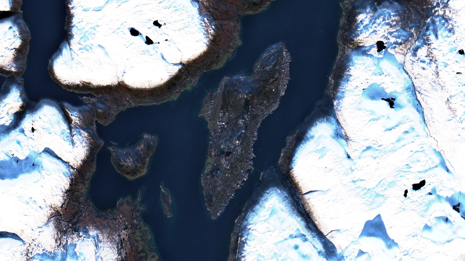
True color composite

Tromsø, Norway
Sensors carried by satellites can image Earth in different regions of the electromagnetic spectrum. Each region in the spectrum is referred to as a band. Sentinel-2 has 13 bands. True color composite uses visible light bands red, green and blue in the corresponding red, green and blue color channels, resulting in a natural colored product, that is a good representation of the Earth as humans would see it naturally.
False color composite
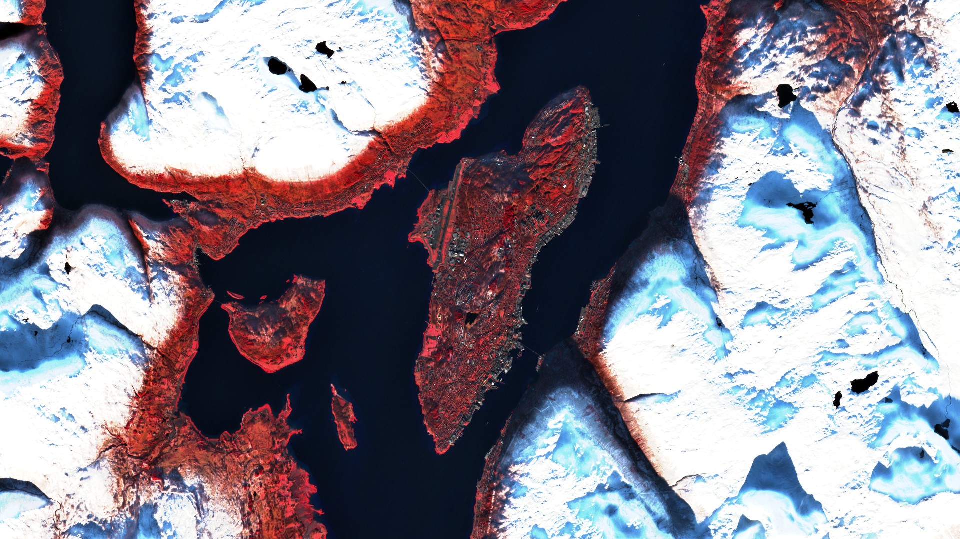
A false color composite uses at least one non-visible wavelength to image Earth. The false color composite using near infrared, red and green bands is very popular (a band is a region of the electromagnetic spectrum; a satellite sensor can image Earth in different bands). The false color composite is most commonly used to assess plant density and health, since plants reflect near infrared and green light, while they absorb red. Cities and exposed ground are grey or tan, and water appears blue or black.
Normalized Difference Moisture Index (NDMI)
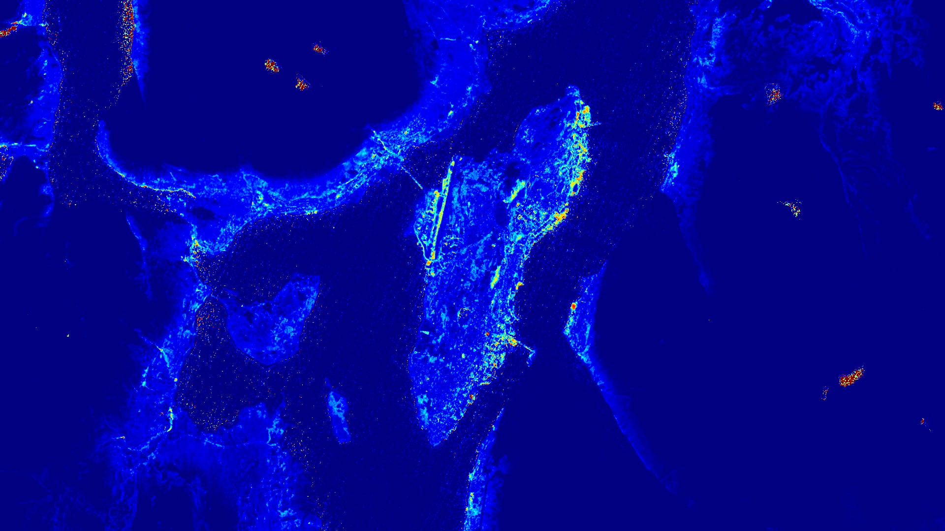
The normalized difference moisture Index (NDMI) is used to determine vegetation water content and monitor droughts. The value range of the NDMI is -1 to 1. Negative values of NDMI (values approaching -1) correspond to barren soil. Values around zero (-0.2 to 0.4) generally correspond to water stress. High, positive values represent high canopy without water stress (approximately 0.4 to 1).
Short wave infrared composite (SWIR)
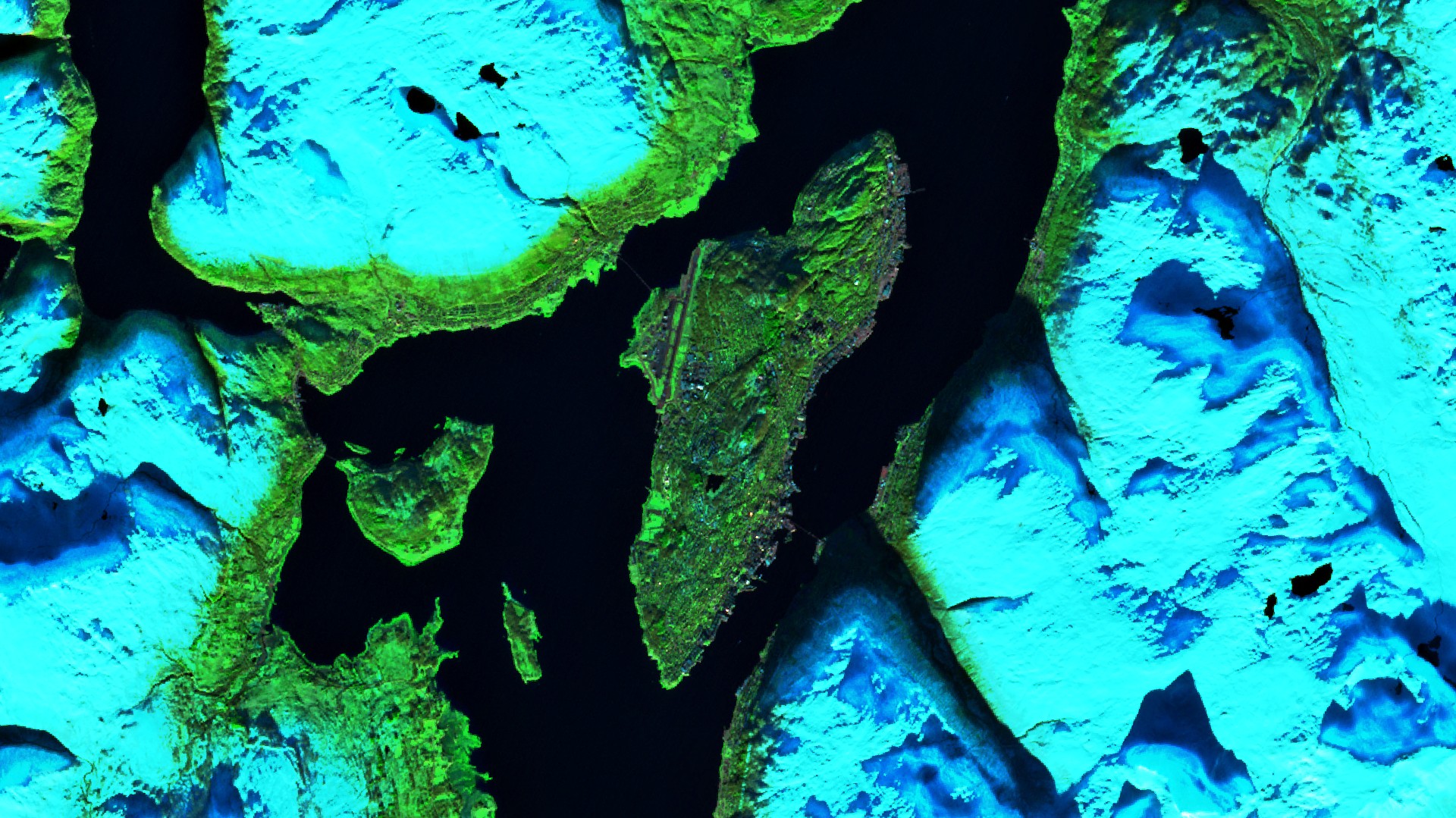
Short wave infrared (SWIR) measurements can help scientists estimate how much water is present in plants and soil, as water reflects SWIR wavelengths. Short wave infrared bands are also useful for distinguishing between cloud types (water clouds versus ice clouds), snow and ice, all of which appear white in visible light. In this composite vegetation appears in shades of red, soils vary from dark to light brown and urban areas are cyan blue. Newly burned land reflects strongly in SWIR bands, making them valuable for mapping fire damages. Each rock type reflects shortwave infrared light differently, making it possible to map out geology by comparing reflected SWIR light.